

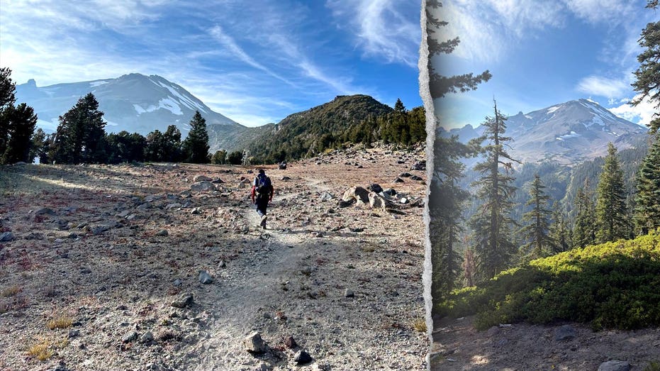

Three novice hikers from Roseville were rescued from California’s Mount Shasta after their climb went off course and left them stranded overnight. The men said they relied heavily on Google Gemini for route and packing advice, including guidance that led them to bring too little food and water. After reaching the summit well past the recommended turnaround time, they descended in darkness, entered Mud Creek Canyon and became trapped after one hiker injured his knee. Forest Service climbing rangers and county search-and-rescue volunteers brought all three hikers safely back to the trailhead the next morning.
| 1) | Rescue After an Overnight Stranding |
|---|---|
| 2) | AI Advice and Insufficient Supplies |
| 3) | A Late Summit and Wrong Turn |
| 4) | Search and Rescue Response |
| 5) | Safety Guidance for Mount Shasta |
Rescue After an Overnight Stranding
The three young men were climbing Mount Shasta in Northern California when their planned ascent turned into an overnight emergency. They had established camp at approximately 8,400 feet on Saturday, Aug. 29, and began their summit attempt at 3 a.m. the following Sunday. Their route eventually led them away from the Clear Creek Route and into the steep Mud Creek Canyon area.
The group contacted the Siskiyou County Sheriff’s Office about an hour after beginning its descent to ask for directions. The hikers later became stranded after one of the men fell and injured his knee. They remained in the canyon overnight until rescuers reached them the next morning. All three hikers and the responding personnel returned safely to the trailhead.
AI Advice and Insufficient Supplies
After the rescue, the hikers told a sheriff’s deputy that they had relied heavily on Google Gemini to help plan the climb. Their use of the artificial intelligence tool included decisions about the route and the amount of food and water to carry.
The sheriff’s office described that reliance as a critical misstep. The hikers said the AI guidance led them to bring substantially less food and water than they needed when an ascent expected to take about eight hours became a multi-day ordeal. The incident highlighted the limits of relying on automated information for route conditions, preparation and mountain safety.
“It is always advisable to call the local USFS Mount Shasta Ranger Station ahead of your trip to ensure you have the most accurate information, and to never rely solely on AI for your trip planning,” the sheriff’s office said.
A Late Summit and Wrong Turn
The hikers did not reach Mount Shasta’s summit until 7 p.m., seven hours after the recommended noon turnaround time. That delay left them descending in the dark, when navigation and route recognition became more difficult.
Although the Clear Creek Route does not require technical mountaineering, the group’s late descent and subsequent navigation error placed it in Mud Creek Canyon, an area authorities identified as especially hazardous. Serious accidents and deaths have occurred when people became lost and entered more dangerous sections of the mountain, including the Mud Creek drainage.
Search and Rescue Response
U.S. Forest Service climbing rangers reached the hikers the morning after they became stranded. The rangers treated the man with the injured knee and assessed the group’s condition in the steep canyon.
Siskiyou County Search and Rescue volunteers were also dispatched to assist. The coordinated response allowed rescuers to guide the hikers out and return them to the trailhead without further reported injuries. The operation followed the group’s overnight call for help and the discovery that it had moved off the intended route.
Safety Guidance for Mount Shasta
Authorities advised climbers to contact the local U.S. Forest Service Mount Shasta Ranger Station before starting a trip. Current local information can help hikers prepare for route conditions and changing mountain hazards more accurately than an automated planning tool alone.
The sheriff’s office also urged climbers who have not reached the summit by noon to turn back. Beginning the descent by that point gives hikers, and rescuers if an emergency occurs, more daylight to leave the mountain. Hikers should carry more than one navigation method, frequently confirm that they remain on the correct route and avoid depending solely on a cellphone or GPS device. They should also be prepared for injuries, bad weather and an unexpected night outdoors.
| Number | Key Point |
|---|---|
| 1 | Three Roseville hikers were rescued from Mount Shasta after becoming stranded overnight. |
| 2 | The group relied heavily on AI for route and supply planning and carried too little food and water. |
| 3 | The hikers reached the summit at 7 p.m., well after the recommended noon turnaround time. |
| 4 | One hiker injured his knee after the group entered Mud Creek Canyon. |
| 5 | Officials recommend checking with Forest Service rangers, carrying multiple navigation tools and turning back by noon if necessary. |
Summary
The Mount Shasta rescue shows how late summit attempts, inadequate supplies and route errors can quickly create a serious backcountry emergency. AI tools may assist with preparation, but authorities say they should not replace current information from local rangers, sound judgment or multiple navigation methods. Following turnaround guidance and planning for injuries, weather and delays can reduce risks for climbers and rescuers.
Frequently Asked Questions
What happened to the hikers on Mount Shasta?
Three novice hikers became stranded overnight after leaving the Clear Creek Route and entering Mud Creek Canyon. One man injured his knee in a fall, and rescuers reached the group the next morning.
How did AI contribute to the incident?
The hikers said they relied heavily on Google Gemini for route and packing advice. They reported bringing too little food and water after following its guidance, which officials called a critical misstep.
What safety steps did authorities recommend?
Officials recommended contacting the local Mount Shasta Ranger Station before a trip, turning back by noon if the summit has not been reached, carrying multiple navigation methods and preparing for injuries, bad weather and an overnight stay.
